
平心而論中時幾乎都很忠實地報導(What is the military media?)特別是;
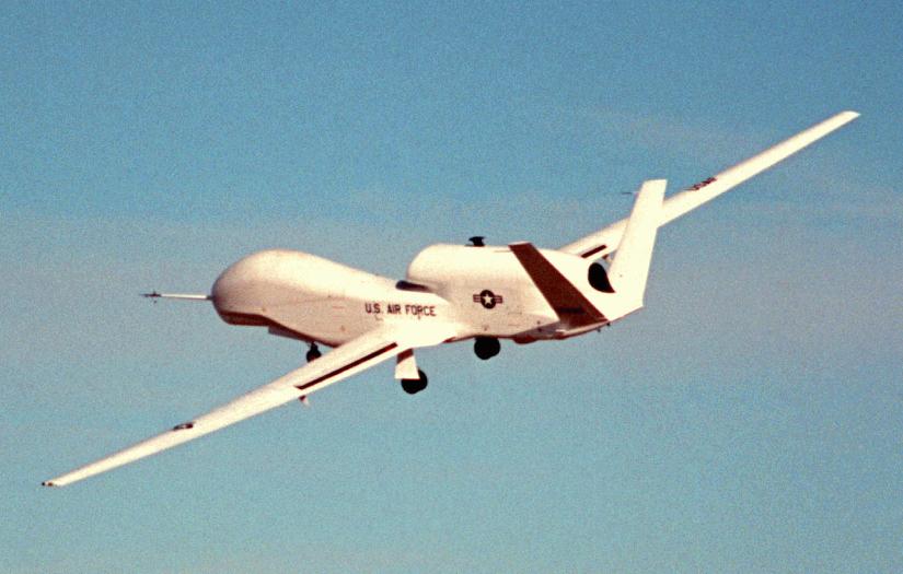
那也不能免俗地來話家常:What is the Global Hawk

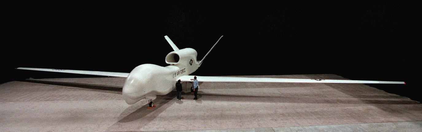
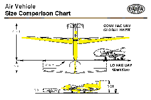
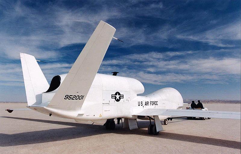
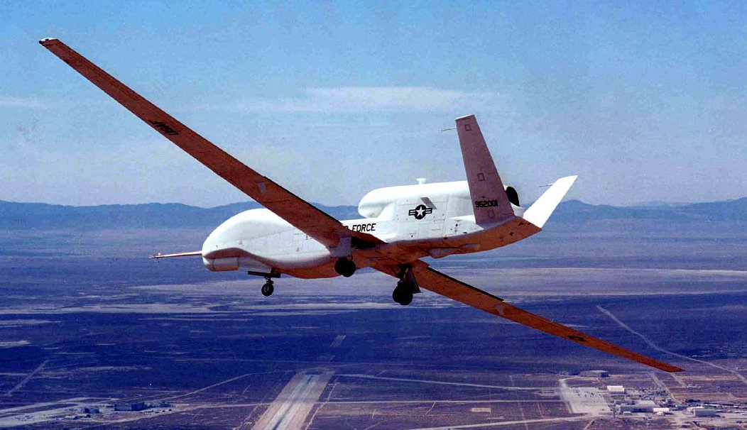
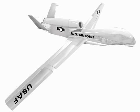
RQ-4A Global Hawk (Tier II+ HAE UAV)
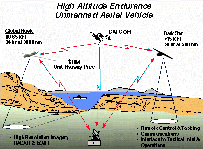
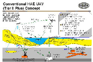
The Tier II Plus air vehicle will be capable of standoff, sustained high altitude surveillance and reconnaissance. It will operate at ranges up to 3000 nautical miles from its launch area, with loiter capability over the target area of up to 24 hours at altitudes greater than 60,000 feet. It will be capable of simultaneously carrying electro-optical (EO), infra-red (IR), and synthetic aperture radar (SAR) payloads, and will be capable of both wideband satellite and Line-Of-Sight (LOS) data link communications. During the development phase, scheduled to conclude 1QFY98, two vehicles, two sets of payloads, and a ground control station will be procured and field tested. Global Hawk's first flight was from Edwards Air Force Base, CA on 28 February 1998.
The HAE UAV will be capable of long dwell, broad area coverage, and continuous spot coverage of areas of interest with high resolution sensors. Global Hawk's 24-hour operationally persistent dwell will support persistently viewing and tracking targets like critical mobile targets. The Global Hawk is focused on the radar integrated into the system for all-weather, wide-area and spot capability that can provide high quality imagery with targeting accuracy.The Global Hawk radar and EO/IR payload are carried simultaneously. Radar is capable of multiple modes -- SAR strip at one meter, SAR spot at a foot, GMTI mode down to four knots operating all at 20 to 200 kilometers range. The EO/IR payload provides NIIRS 6 or 5.5 depending on whether it's EO or IR. Global Hawk will integrate with the existing tactical airborne reconnaissance architectures for mission planning, data processing, exploitation, and dissemination. It will provide both wide area search radar and EO/IR imagery (40,000 sq nm per mission) at 1m resolution and up to 1900 spot images per mission at 0.3m resolution, and will support targeting accuracy of at least 20m CEP.
When linked with systems such as the Joint Deployable Intelligence Support System (JDISS) and the Global Command and Control System (GCCS), imagery may be transferred NRT to the operational commander for immediate use. HAE UAV data will be accessible for Indications and Warning (I&W), cueing, rapid strike/restrike tasking, combat assessment and further analys is up and down the chain of command within minutes of receipt.
The HAE UAV will strive for commonality with existing Command, Control, Communications, Computers, and Intelligence (C4I) architecture. Collected imagery will be transferred to theater designated exploitation sites utilizing standard formats through existing communications mediums. Selected frames of imagery and reports can be broadcast electronically by voice or data. The operational commander will determine the preferred means of dissemination and distribution.
The system is capable of both direct line of sight communications with the ground station by a common data link or beyond line of sight through Ku band SATCOM, direct line of sight capability, good support up to 274 megabits per second (although this is not currently supported) and 50 megabits per second by a Ku band SATCOM. In the future users detached from the ground station could directly receive imagery data from the Global Hawk.
When Global Hawk missions are allocated to Army commanders, or an Army officer is the JTF commander, the Enhanced Tactical Radar Correlator (ETRAC) and Modernized Imagery Exploitation System (MIES) (or successor processors) will process the imagery. If the U.S. Air Force is the "lead" Service, the processor would be the Contingency Airborne Reconnaissance System (CARS); if the Navy and Marines go in first, the Joint Services Imagery Processing System-Navy (JSIPS-N) would process the imagery. The Common Ground Station (CGS) will display the imagery no matter which system processed it.
In fiscal year 1999, Global Hawk flying quality flights were flown, and military utility flights were to commence in April. In March, 1999, a Global Hawk vehicle, with its sensors, went out of control and was destroyed. This crash has delayed the Global Hawk military utility study at least two months,
On 16 February 2000 Northrop Grumman Corp. of San Diego CA was awarded a $71,999,635 modification to a cost-plus-award-fee contract, MDA972-95-3-0013, to provide for two prototype Global Hawk unmanned aerial vehicles, associated system modification, and engineering support. Expected contract completion date is March 31, 2002.

美無人偵察機全球之鷹 進駐關島
2010/09/27 03:26吳明杰/關島安德森空軍基地採訪報導
中國時報【吳明杰/關島安德森空軍基地採訪報導】
繼七月在夏威夷進駐F-22猛禽戰機後,美軍上周又在關島安德森空軍基地正式部署「全球之鷹」無人偵察機(RQ-4 Global Hawk)。對外界認為此舉與監控中共和北韓軍事動態有關,美國太平洋空軍司令諾斯上將(GARY L. NORTH)受訪時表示,美國是亞太國家之一,有責任協助維護此區域安全。
不過他也強調,在關島部署「全球之鷹」無人偵察機,絕非是為了特定國家或特定任務,而是因應美軍全球任務的需求,是「全球之鷹」全球性部署的一部分,當然除了美國本身的需求,也是希望藉由整個情蒐平台的整合,能進一步分享情資給美國在亞太地區的盟邦。
由於關島無論離北韓或是南海、東海甚至黃海,飛行航程都不超過四小時,而全球之鷹可以滯空達三十小時並維持六萬英尺高度進行高空偵查,包含大陸東部沿海區域都在「全球之鷹」的偵照範圍內。
但無論是諾斯上將或未來負責指揮這批偵察機行動的安德森基地、太平洋空軍第三十六作戰中隊指揮官卡萊梭中將(Herbert J. Hawk Carlisle)等都一再聲稱,如果要說美軍這項部署動作與中共有關,那答案絕對是否定的。
令人玩味的是,七月中美軍正式將一中隊的F-22猛禽戰機進駐夏威夷,當時進駐典禮聲勢相當浩大,並採取戶外露天的方式舉行,諾斯上將當時還公開表示,F-22將讓美國空軍在亞太維持五十年優勢。
然同樣是由諾斯上將主持位在關島的這場「全球之鷹」進駐典禮,在天氣良好情況下反而選在室內舉行,「全球之鷹」也未像F-22進駐夏威夷時進行空中飛行展示,整個典禮氣氛低調許多。
連同記者登上「喬治華盛頓號」航空母艦採訪期間,相關美軍將領只要被及與中共有關的問題,答覆都轉向保守謹慎,甚至避而不答,與兩個月前記者在夏威夷採訪美軍演習所感受到的美軍對中共態度已有轉變。
針 對為何選在關島部署「全球之鷹」,諾斯上將解釋說,這款新型偵察機,可以用來和其他偵察機進行情資整合,讓地面的軍事決策者,可以即時收到最新的空照情 報,用以決定下一步行動,如果翻開亞太地圖,就可以發現關島最適合部署「全球之鷹」的地點,因為這個位置相當有助於美軍任務的執行和需求。

 留言列表
留言列表 【蔡英文說想想】:【中華民國國家作戰系統安全藍圖】
